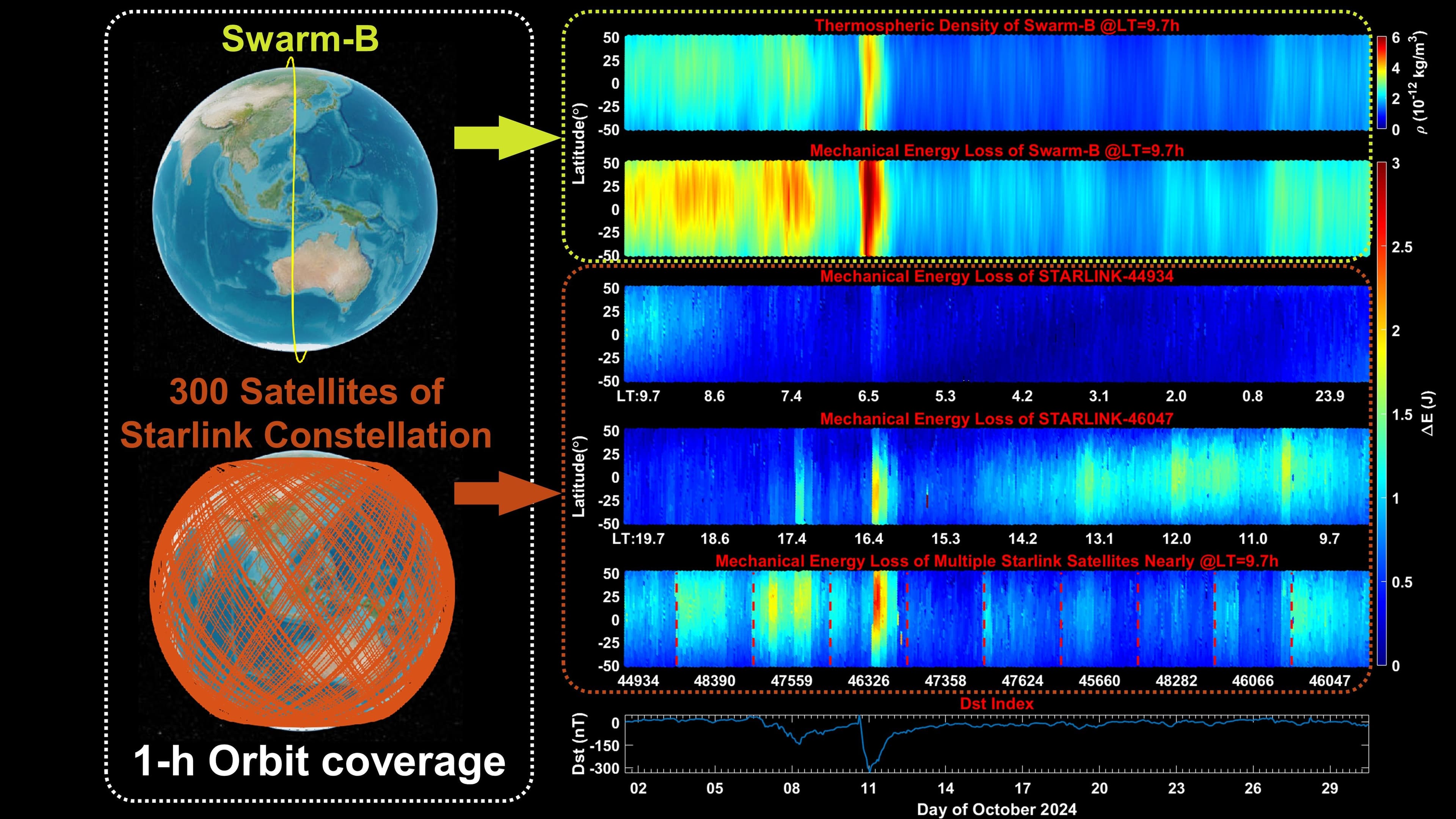
Starlink's publicly available near-real-time ephemeris data, published since 2021, is now a primary research tool for thermospheric science. Mamoru Yamamoto applied tomographic reconstruction to this data, achieving density measurements of the thermosphere with resolution comparable to the dedicated ESA SWARM-B research satellite. A parallel 2025 paper by Zhuoliang Ou et al. in Remote Sensing independently validated that Starlink ephemeris data matches SWARM-B output directly.
The thermosphere sits between 100 km altitude and the exosphere boundary above 600 km. It hosts the ISS, Tiangong, and the entire Starlink constellation. Its density shifts with solar irradiation, making continuous, high-resolution monitoring difficult and expensive with traditional dedicated satellites. Yamamoto's tomographic method replaces the standard two-line element set approach, using a broader dataset to reconstruct density across a larger spatial volume rather than inferring single-point measurements.
The full papers are worth reading for the methodology gap they expose: Yamamoto's tomography section explains exactly why TLE-based approaches underperform and how the reconstruction geometry works across multiple satellite passes. The implication is that a 6,000-plus satellite broadband network has become, by accident, the densest atmospheric sensor array ever deployed in the thermosphere.
[READ ORIGINAL →]